Showing Wainwright Maps of the Lakeland Fells: Map 7, The Western Fells by A. Wainwright
no recommendations yet

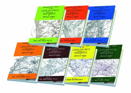
WAINWRIGHT MAPS OF THE LAKELAND FELLS
COMPLETE SET OF SEVEN MAPS: Eastern, Far Eastern, Central, Southern, Northern, North Western and Western Fells.
Based on and correspond to the Wainwright Pictorial Guides of the English Lake District by Alfred Wainwright.
Note - not intended for use as a navigation aid.
- Dimensions of each map - 21.8 x 12.8 x 0.8 cm
-Folded
-Seven maps in total
-Chop McKean Mapping
A perfect gift. Secure your purchase by clicking the shopping basket button at the top right of the screen now.
COMPLETE SET OF SEVEN MAPS: Eastern, Far Eastern, Central, Southern, Northern, North Western and Western Fells.
Based on and correspond to the Wainwright Pictorial Guides of the English Lake District by Alfred Wainwright.
Note - not intended for use as a navigation aid.
- Dimensions of each map - 21.8 x 12.8 x 0.8 cm
-Folded
-Seven maps in total
-Chop McKean Mapping
A perfect gift. Secure your purchase by clicking the shopping basket button at the top right of the screen now.
Important places
Regions
- Cumbria (310)
Countries
- United Kingdom (21,421)
Other geographical areas
- North West (956)
- North of England (7,026)