Showing Mannahatta: A Natural History of New York City by Eric W. Sanderson
No recommendations yet View on Amazon (paid link)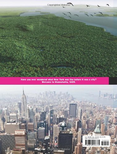
It's difficult to imagine today what Manhattan would have looked like to its early explorers - before the skyscrapers, the crowded sidewalks and the busy intersections. Ten years ago landscape ecologist Eric Sanderson came across a British Headquarters map from 1782. By geographically matching, or geo-referencing, this historical map with a map of modern Manhattan and examining volumes of historical documents and journals, he has been able to visually reconstruct, down to the city block, what Manhattan looked like four hundred years ago, from the forests of Times Square, the wetlands of downtown, the meadows of Harlem and the Upper West Side and the nomadic tribe settlements of Chinatown and the Upper East Side.Although the lush forests, rolling hills and flowing streams have long disappeared, "Mannahatta: A Natural History of New York City" brings this wild island of Henry Hudson's era to life through insightful text, maps, illustrations, and computer visualisations. Published to coincide with New York's 400 year anniversary, "Mannahatta" is not only a view of the past, but is also an inspiration for a new vision of the future.